Background
Agricultural land in Washington State is under threat of conversion to more developed land uses. The Washington State Conservation Commission has identified the need for conservation districts to have access to a database of parcels and owners of agricultural land in Washington State. Building off of a synergistic projects to create the 2019 Washington State Parcel and Forestland Databases, this project will develop the first normalized, spatially explicit, statewide database of agricultural parcels and owners.
Our Work
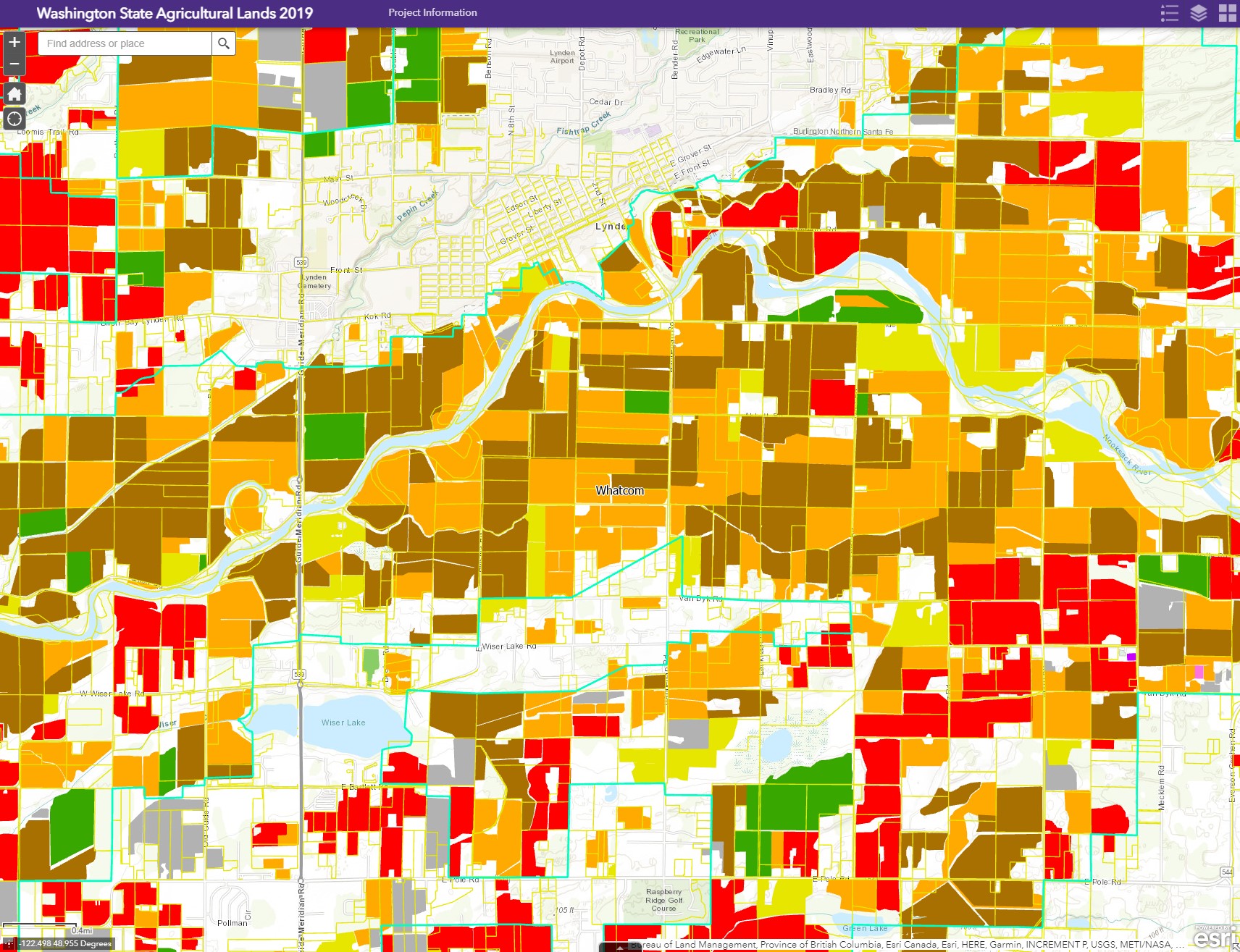
The Washington State Agland Database combines land ownership, land use and assessment information with physical characteristics of the land to develop economic, social and environmental metrics about the agriculture land base. The spatially-explicit information in the database allows for analysis at the watershed, county and state level. This high-resolution dataset can produce maps, statistics and models at multiple scales. Using previously developed versions of the Parcel Database, two versions of the Agland Database were developed. This allows for a change in the agricultural land base over 10 years to be analyzed. The Agland Database is a comprehensive platform for understanding how agricultural ownership and land use is changing, thereby enabling new science and research to inform public policy analysis, debate and action.
Results
Three primary products were developed: the Washington State Agland Database, statistics on the numbers and acres of agland parcels; and maps of the distribution of parcels. Statistics derived from the Database reveal that 92,000 landowners own 12.4 million acres of agland, with 6.7 million acres of cultivated land. Since 2007, 292,000 acres of agricultural lands have converted to other land uses. Maps show the distribution of parcels that have converted.

Deliverables
Reports
Presentations
Online workshop presented June 21, 2021
Maps
Data
WA_Agland_Statistics_2019.xlsx
WA_Agland_Statistics_2019_Trends.xlsx
Data Request
ArcGIS Online Web Service
UW ArcGIS Server Map Service

